

Wigwam, Monument fire updates
Fires top 4,000 acres each - Wigwam 4,190; Monument, 5,733
U.S. Forest Service
DAILY UPDATE for MONUMENT and WIGWAM FIRES,
August 17, 2018
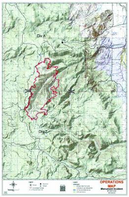
Monument Fire: 5,733 acres, 5% contained
Equipment and manpower - Engines: 8; Water Tenders: 4; Total Fire Personnel: 123
Wigwam Fire: 4,190 acres, 0% contained
Equipment and manpower - Engines: 11; Dozers: 1; Water Tenders: 6; Total Fire Personnel: 115
Helicopters utilized for both fires: 3
The Monument and Wigwam Fires are full suppression fires managed to limit fire spread and protect structures and other public and private values at risk. Public and firefighter safety is always the first priority during fire suppression.
Fire activity moderated with increased clouds and slightly cooler temperature in the afternoon. The southern part of Monument Fire burned into the head of Ruby Creek, consuming most available fuels. Part of the north end of Monument Fire burned into Dry Gulch and is being monitored. Crews completed firelines around all spotfires on Wigwam Fire from previous day fire activity. Airtankers dropped retardant on ridges northwest of Wigwam Fire and help check further fire spread.
Last night’s operation was focused on crew and engine patrols on both fires and structure protection.
Helicopters continue to support both fires. Fixed wing air tankers are available when needed. Crews will continue structure protection, evaluating opportunities for direct suppression, locating contingency lines, and suppress spot fires. A contingency line is being constructed to enhance structure protection for homes and private property in the Haypress Lake area.
Concerns
- Weather concerns will be scattered thunderstorms in the afternoon through Saturday morning. High temperatures in the mid- to upper-70s with minimum RHs 15-25%. General winds west to southwest 5-15 mph.
- Red Flag Warning remains in effect until August 18 at 12 AM.
Stage 1 fire restrictions are in effect on the Beaverhead-Deerlodge National Forest apply to campfires and smoking. (See full restrictions at https://www.fs.usda.gov/alerts/bdnf/alertsnotices/?aid=48488)
The fires are located south and west of Ennis, MT in very rough mountainous terrain, in the 9,000-foot elevation range, within the Gravelly Range Mountains south of Ennis, Montana. They are burning in whitebark pine and subalpine
fir, with approximately 70% standing dead timber from bug kill and other natural conditions. Southern California Incident Management Team 3 is managing both the Monument and the Wigwam Fires for full suppression.
